
It was unbelievable that 3 storms appeared at the same time. The 2 storms formed at South China Sea, meanwhile a typhoon under Category III was heading to East China Sea between mainland China & Japan islands. (The storms currently active)
On the 25th August 2010, a disturbance is formed at the east of Cagayan, Philippines. On the next day, the disturbance started to move west and later crossed the island of Luzon but on the next day, the circulation became slightly disorganized due to dry air. Later on, the Joint Typhoon Warning Center (JTWC) issued a Tropical Cyclone Formation Alert (TCFA) which was later upgraded to a tropical depression. On the 28th August, the JMA upgraded the system to a Tropical Storm and was named "Lionrock". On the next couple of days, Lionrock remains almost stationary in South China Sea. On 31st August, Lionrock started to move northeast slowly due to interaction with tropical storm Namtheun. Early on 1st September, Lionrock made a Fujiwhara effect with Namtheun, whilst Lionrock maintained it's strength while Namtheun was absorbed. Lionrock made landfall on the east coast of Guangdong Province, China, just north of the city of Shantou. It then stated to dissipate and weaken into a tropical storm and moved over Guangzhou, Guangdong's capital. Lionrock soon lost it's intensity as it went over Guangdong and on 3rd September, the storm had turned into a low pressure area.
On the 27th August 2010, a disturbance is formed at the east of Yap Island near Guam. On the next day, the disturbance was located at northwest of Guam. At that time, the Japan Meteorological Agency (JMA) upgraded the system into a tropical depression. On the 29th August, the JTWC issued a TCFA on the system had become organized. JTWC announced that the system had quickly developed into a tropical storm. Intensification continued, the JMA reported that the depression had intensified into a tropical storm and assigned it "Kompasu". The JMA reported that Kompasu had intensified rapidly into severe tropical storm. At the same time, the JTWC also upgraded Kompasu into a category 1 typhoon (max wind 120km/h). On the next day, Kompasu crossed the island of Kadena and rapidly intensified into a category 2 typhoon (max wind 155km/h). On 1st September, Kompasu upgraded as a category 3 typhoon (max wind 180km/h), becoming the strongest typhoon of the 2010 season. Later, the storm weakened to a category 1 typhoon in the Yellow Sea before veering northeast and making a landfall on Ganghwa Island, northwest of Incheon and Seoul, killing at least 4 people. Kompasu was the strongest tropical storm to hit the Seoul Metropolitan area in 15 years. Kompasu weakened to a tropical storm over the sea of Japan on 2nd September.

 Tropical storm tracks taken on 02.09.10

Tropical storm tracks taken on 03.09.10


On 1st September 2010, Malou started out as a tropical depression wardering around the Western Pacific. It remained for a depression for two days before it strengthened into a tropical storm and given the name Malou. Malou drifted over the Ryukyu Islands and became a severe tropical storm. After passing through Ryukyu Islands, Malou was expected to make a landfall on Jeju Island on 7th September. It then moved along the coast of Honshu and made another landfall Tsuruga, Japan on 8th September. After the second landfall, Malou weakened into a tropical depression until it dissipated on 10th September.
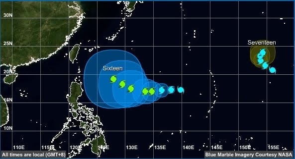
Tropical storm tracks taken on 04.09.10
 Tropical storm tracks taken on 05.09.10
 Tropical storm tracks taken on 06.09.10
 Tropical storm tracks taken on 07.09.10

Early on 6th September 2010, the JMA reported that a tropical depression had formed about 330km to the southeast of Taipei, Taiwan. Later that day, the depression had an unorganized low level circulation center and was located in a favorable environment of decreasing vertical windshear and high sea temperatures. During the next day as the depression moved towards Taiwan the system became better organized with a tropical cyclone formation alert issued later that day. In the morning of 9th September, JMA upgraded the cyclone into a tropical storm, and it was named Meranti. After Meranti upgraded into a tropical storm, it continued to move northward into Taiwan Strait. In the early hours of 10th September, Meranti made a landfall at Shishi City, China. It continued to move north inland Fujian Province. In the evening of 10th September, the JMA downgraded Meranti into a tropical depression.
Tropical storm tracks taken on 08.09.10
 Tropical storm tracks taken on 09.09.10
 Tropical storm tracks taken on 14.09.10
 Tropical storm tracks taken on 15.09.10
 Tropical storm tracks taken on 16.09.10

Tropical storm tracks taken on 17.09.10
 Tropical storm tracks taken on 18.09.10
 Tropical storm tracks taken on 19.09.10

 Tropical storm tracks taken on 18.09.10
 Tropical storm tracks taken on 19.09.10

Tropical storm tracks taken on 20.09.10
 Tropical storm tracks taken on 21.09.10
 Tropical storm tracks taken on 22.09.10
 Tropical storm tracks taken on 23.09.10


 Tropical storm tracks taken on 21.09.10
 Tropical storm tracks taken on 22.09.10
 Tropical storm tracks taken on 23.09.10

Tropical storm tracks taken on 13.10.10
 Tropical storm tracks taken on 14.10.10
 Tropical storm tracks taken on 15.10.10
 Tropical storm tracks taken on 16.10.10
 Tropical storm tracks taken on 17.10.10
 Tropical storm tracks taken on 18.10.10 (landfall)
 Tropical storm tracks taken on 18.10.10 (after landfall)
 Tropical storm tracks taken on 19.10.10
 Tropical storm tracks taken on 20.10.10
 Tropical storm tracks taken on 21.10.10


 Tropical storm tracks taken on 22.10.10


 Tropical storm tracks taken on 23.10.10
 Tropical storm tracks taken on 25.10.10
 Tropical storm tracks taken on 26.10.10
 Tropical storm tracks taken on 27.10.10 (to be updated later)

 Tropical storm tracks taken on 14.10.10
 Tropical storm tracks taken on 15.10.10
 Tropical storm tracks taken on 16.10.10
 Tropical storm tracks taken on 17.10.10
 Tropical storm tracks taken on 18.10.10 (landfall)
 Tropical storm tracks taken on 18.10.10 (after landfall)
 Tropical storm tracks taken on 19.10.10
 Tropical storm tracks taken on 20.10.10
 Tropical storm tracks taken on 21.10.10

 Tropical storm tracks taken on 22.10.10


 Tropical storm tracks taken on 23.10.10
 Tropical storm tracks taken on 25.10.10
 Tropical storm tracks taken on 26.10.10
 Tropical storm tracks taken on 27.10.10 (to be updated later)


